Dwarka Underwater City: The Archaeology That Matches the Mahabharata
Marine excavations off the coast of Dwarka, begun in 1983 by Dr. S.R. Rao of the Archaeological Survey of India, have uncovered submerged stone structures, triangular stone anchors, pottery, and inscribed seals dated between 1500 BC and 3500 BC. These findings match the Mahabharata's description of a great coastal city built by Lord Krishna that was eventually claimed by the sea. The site is not accessible to tourists, it lies 5 to 12 metres underwater, but its implications for understanding both ancient Indian maritime civilization and the historical basis of the Mahabharata narrative are significant.
Useful References
What the Mahabharata Says About Dwarka's Submersion
The Mahabharata, specifically the Mausala Parva (the Book of the Clubs), the 16th of the 18 parvas, describes in detail the events following Lord Krishna's departure from the mortal world. The text narrates that after Krishna was accidentally struck by the hunter Jara's arrow and left his body, the sea began to encroach upon Dwarka. The Yadava clan had already destroyed itself in internal conflict (the Mausala, or club, war), and with Krishna gone, there was no divine force protecting the city from the sea.
The account in the Mausala Parva is specific: Arjuna, arriving in Dwarka after hearing of Krishna's death, sees the sea advancing on the city house by house, street by street, over several days. He evacuates the surviving women, children, and elderly before the final submersion. The text describes Dwarka as a city of extraordinary beauty and architecture, golden spires, gem-studded towers, wide avenues, harbours, that vanished beneath the waves leaving only the Dwarkadhish Temple site (Kushasthali) above water. This narrative is the theological and geographical background against which the modern temple town of Dwarka exists.
What makes this account unusual among ancient religious texts is its specific claim of a dateable, archaeologically observable event, the submersion of a coastal city. Most mythological narratives describe events in non-physical realms or in cosmic time scales that resist archaeological verification. The Dwarka submersion narrative makes a physical claim: a specific city, on a specific coast, was claimed by the sea after a specific historical event (the end of the Dvapara Yuga). When S.R. Rao's excavations began finding evidence of exactly such a submerged coastal settlement, the intersection of archaeology and religious text became impossible to dismiss as coincidence.
The S.R. Rao Excavations: What Was Found and When
Dr. Shikaripur Ranganatha Rao was one of India's most distinguished archaeologists, the man who deciphered the Indus script and led the excavation of the Harappan port city of Lothal in Gujarat. His interest in the Dwarka underwater site came from his expertise in ancient Indian maritime history. In 1983, the ASI's Marine Archaeology Centre (located in Goa, in collaboration with the National Institute of Oceanography) began systematic underwater surveys off the Dwarka coast. The initial surveys used surface diving and later graduated to SCUBA-assisted excavation.
The first underwater survey of the Dwarka coastal zone identified an area of anomalous stone formations approximately 0.5 to 1 km offshore from the Dwarkadhish Temple. Natural rock formations were distinguished from apparent worked stone. The surveys confirmed that structured remains, walls or floor foundations, existed underwater.
Over multiple diving seasons, the team documented stone walls aligned in a roughly geometric pattern inconsistent with natural formation. Triangular stone anchors, a distinct type used in ancient Harappan and post-Harappan maritime trade, different from the T-shaped anchors of Mediterranean civilizations, were recovered. Pottery shards were collected and sent for dating.
Carbon dating of organic material associated with the pottery and the wood remains produced dates in the range of 1500 BC to 3500 BC. The pottery typology was consistent with late Harappan ceramic traditions. Inscribed seal-like objects were found, their script has not been definitively deciphered but bears similarity to known Harappan symbols.
S.R. Rao published his findings in the book "The Lost City of Dwarka," which remains the primary academic account of the excavations. The book argues that the submerged structures represent an actual ancient settlement, possibly the Bronze Age city referenced in the Mahabharata, and not merely natural underwater formations.
The National Institute of Ocean Technology conducted further sonar and diving surveys in the Gulf of Khambhat and off Dwarka. Some NIOT surveys have claimed findings of even older structures in the Gulf of Khambhat (unrelated to Dwarka directly), though these remain more contested. The ASI's Underwater Archaeology Wing continues periodic surveys at the Dwarka site.
The Archaeological Evidence: What It Does and Does Not Prove
Honest engagement with the Dwarka underwater findings requires distinguishing between what the evidence establishes and what remains interpretive. What the evidence clearly establishes: there is a submerged archaeological site off the coast of Dwarka with worked stone structures, human-made anchors, and datable pottery consistent with a Late Bronze Age / early post-Harappan coastal settlement. The site is real, the structures are man-made, and the dates are consistent with the general period in which the Mahabharata events are traditionally placed (the transition from Dvapara to Kali Yuga, often placed by scholars at approximately 3000-1500 BC).
What the evidence does not prove, and what mainstream archaeology does not claim, is a direct identification of the submerged site as "Krishna's Dwarka" in a literal biographical sense. Archaeological evidence can establish the existence of an ancient coastal settlement that was submerged due to sea level rise (a well-documented geological phenomenon along the Indian western coast in the post-glacial period, approximately 10,000-3,000 years ago). It cannot confirm the specific religious and mythological narrative of the Mausala Parva. The correspondence between the text's description and the archaeological reality is striking and meaningful, but the leap from "an ancient settlement was submerged here" to "this is specifically the city described in the Mahabharata" is an interpretive step rather than a proven archaeological conclusion.
For pilgrims, this distinction matters less than for academic archaeologists. The religious significance of Dwarka as a Char Dham site does not depend on archaeological verification, it rests on thousands of years of continuous devotional tradition. But for thoughtful pilgrims who wonder whether the Mahabharata's account of Dwarka has any physical basis, the answer provided by the underwater excavations is genuinely interesting: the physical evidence is consistent with the narrative in specific and testable ways. This is more than can be said for most ancient mythological accounts, and it gives the Dwarka pilgrimage a dimension of historical and archaeological depth that few sacred sites in the world can match.
Why the Sea Reclaimed Dwarka: The Geology
The submersion of ancient coastal settlements along the Indian western coast is not mythologically unique to Dwarka, it is a documented geological reality. After the last Ice Age, sea levels along the Indian coast rose significantly as glaciers melted worldwide. The post-glacial sea level rise affected the Gulf of Khambhat region particularly, this embayment of the Arabian Sea was partially dry land during the Ice Age's lowest sea levels and gradually flooded over millennia as global temperatures rose. Ancient settlements built on what was then coastline or near-coast terrain would have been gradually submerged as sea levels rose.
Geological surveys of the Gujarat coast have confirmed that the shoreline has moved inland significantly over the past 5,000-10,000 years. Areas that were coastal settlements, harbours, or even slightly inland during the early Holocene are now underwater. This makes the existence of submerged structures off the Dwarka coast geologically predictable, the real question was always whether any such structures could be found, and the answer from the 1983 excavations onward has been affirmative.
The Dwarkadhish Temple itself sits on a slight elevation, "Kushasthali" in ancient texts, that kept it above the rising sea level while the lower city areas were submerged. The Gomti River, the ghats, and the current Dwarka peninsula are what remains of a once-larger coastal urban area. When the Mahabharata describes the sea advancing on Dwarka "house by house," this is consistent with what gradual coastal flooding from sea level rise would look like to inhabitants, not a sudden wall of water (that would be a tsunami narrative) but a creeping advance over days, years, and generations.
Visiting Dwarka with This Knowledge
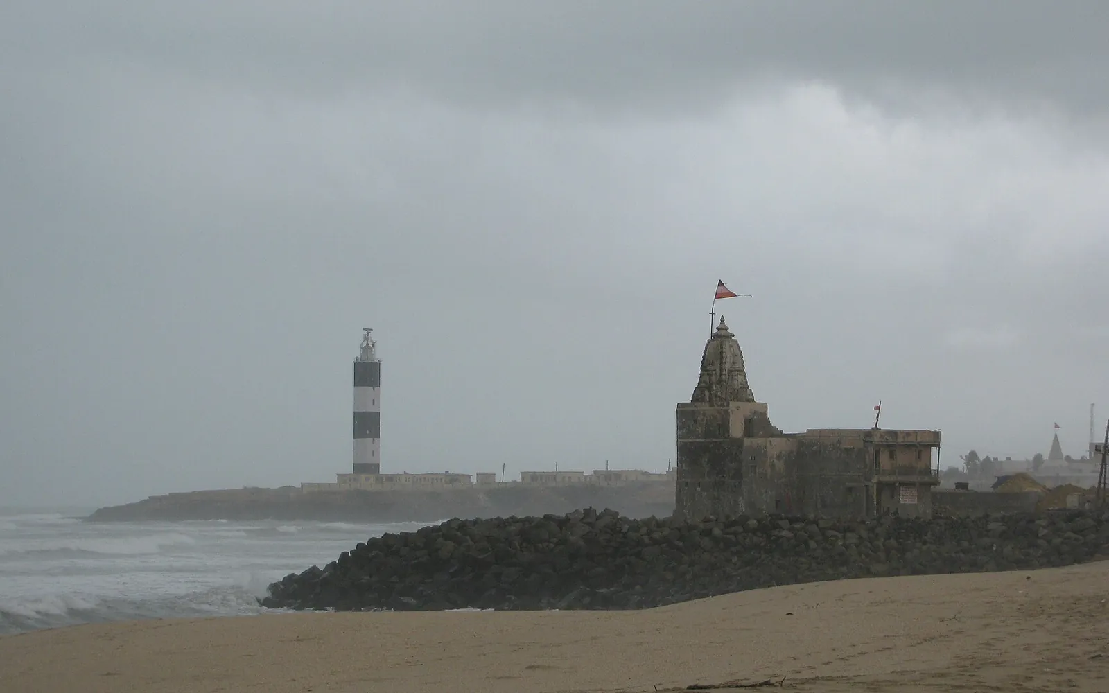
The underwater site is not accessible to tourists, there is no diving programme, no viewing platform, no glass-bottom boat service. The structures are 5 to 12 metres deep in murky coastal waters with limited visibility, and the ASI does not permit recreational access to archaeological sites. Pilgrims and visitors cannot see the submerged ruins directly. However, standing on Gomti Ghat or on the banks near the Dwarkadhish Temple and looking out at the water, you are looking over the area where the ancient city lies. The knowledge of what is beneath the surface adds a layer to any visit that is genuinely moving.
Some artefacts and documentation from the excavations are available through published sources. S.R. Rao's "The Lost City of Dwarka" (1999, National Institute of Oceanography) is the primary text. Academic papers by Rao and subsequent researchers are available through the ASI and NIO publication archives. A small exhibit at the Dwarkadhish Temple museum area provides context for visitors who want to understand the archaeological background of the site they are visiting. The temple trust staff and local priests are generally knowledgeable about the underwater city narrative and many are happy to discuss it with interested pilgrims.
For those who want to understand Dwarka at its fullest depth, not just as a contemporary pilgrimage site but as a place with a history extending back over three thousand years and a geography shaped by the same sea level changes that the Mahabharata describes, the underwater city gives the entire pilgrimage a dimension of temporal scale that is humbling. The temple you are entering today is the latest in a succession of temples on this sacred spot. The city surrounding it is a remnant of something much larger and older. The sea outside the ghat walls covers what was once a metropolis. Knowing this transforms a devotional visit into something also philosophically and historically profound.
Frequently Asked Questions
Also Read
Dwarka History
The complete history of Dwarka, from the Mahabharata era through the Adi Shankaracharya period to the temple's multiple reconstructions.
Read MoreDwarkadhish Temple
The main temple at Dwarka, architecture, history, darshan timings, and visitor information.
Read MoreGomti Ghat Dwarka
The sacred river ghat adjacent to Dwarkadhish Temple, where the Gomti meets the sea above the submerged ancient city.
Read MoreMul Dwarka Temple
Near Kodinar, the site tradition calls the original Dwarka, with archaeological findings of its own, distinct from the submerged city here.
Read More